Where ground access ends, Aerogrid begins. Advanced drone solutions for surveying, inspection, and aerial data — built for industries that can't afford errors.
Aerogrid Drone Solutions is a specialist drone technology company headquartered in Chhattisgarh, delivering actionable aerial data to some of Central India’s most demanding industries.
We combine advanced UAV technology, LiDAR, photogrammetry, and real-time data analytics to give construction companies, infrastructure planners, land developers, and government agencies the ground-truth visibility they need — without ever slowing a project down.
From site surveys before the first shovel breaks ground, to progress monitoring across active worksites and volumetric analysis in active mines.
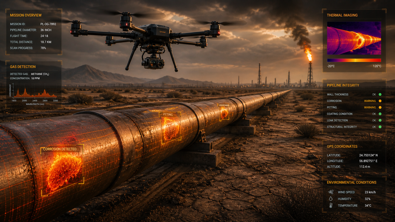
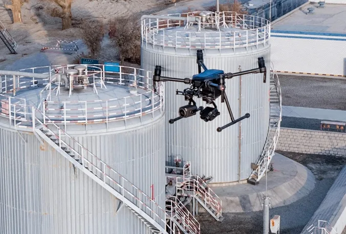
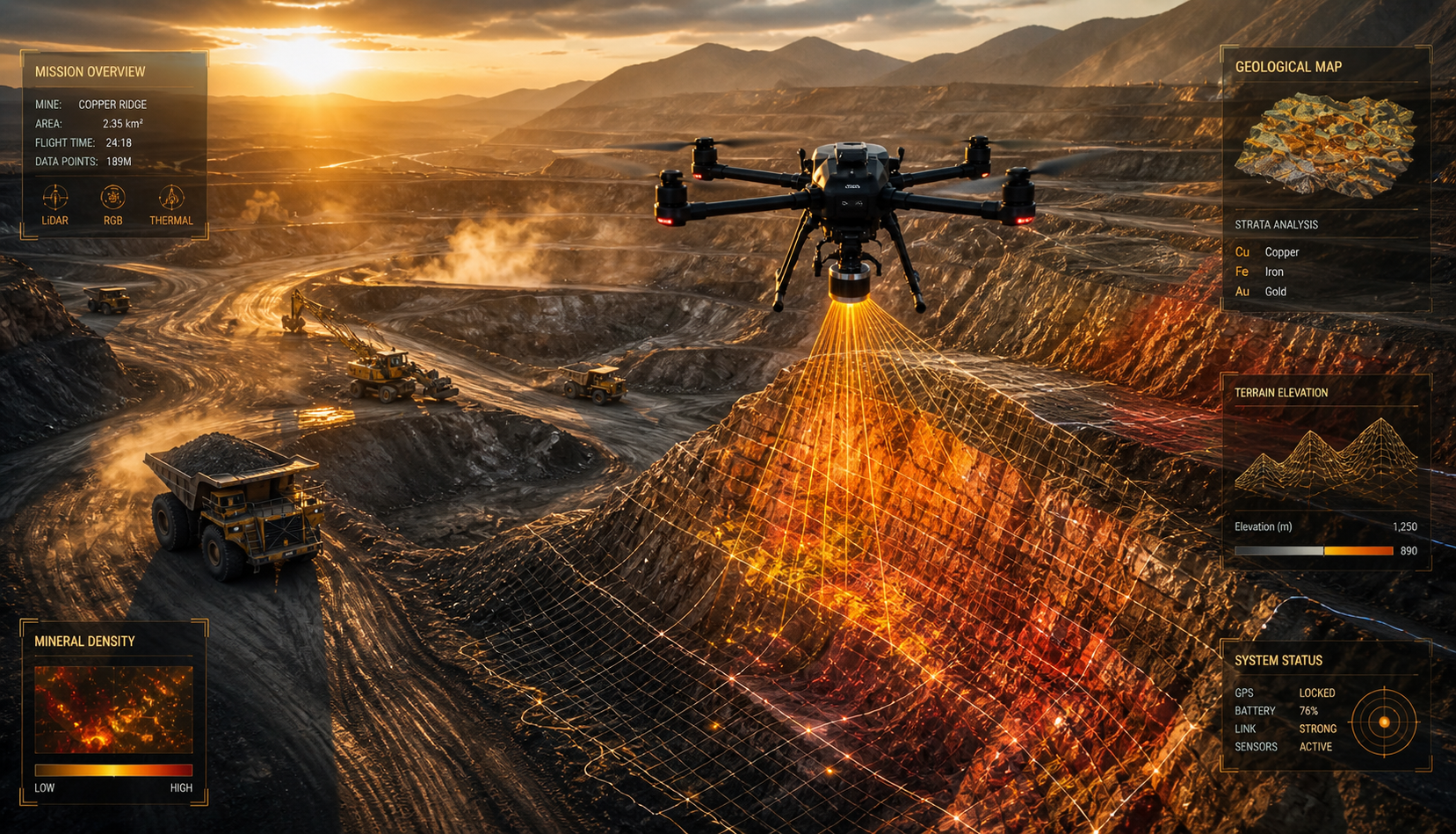
Construction & Real Estate | Mining & Quarrying | Agriculture & Agribusiness | Oil & Gas | Power & Energy | Telecom | Defence & Government | Industrial Facilities
Precision Aerial Solutions Across Every Critical Sector
We engineer our drone services to match the exact demands of your industry — delivering reliable, centimetre-accurate data wherever your project demands it.
GIS Surveying & Mapping
High-resolution aerial mapping, 3D terrain models, and georeferenced datasets for land acquisition, planning, and site management.
From Briefing to Deliverable — A Process Built For Speed and Accuracy
Consultation & Requirement Mapping
We understand your project scope, site conditions, deliverable requirements, and timelines.
Flight Planning & Regulatory Clearance
Our operations team prepares detailed flight plans and obtains all required DGCA permissions.
Aerial Data Acquisition
Certified pilots execute precision missions using the appropriate sensor payload for your project needs.
Data Processing & Analysis
Raw aerial data is processed using photogrammetry, LiDAR processing, and GIS software to produce accurate, usable outputs.
Deliverable & Reporting
Final datasets, maps, 3D models, inspection reports, and analysis outputs are delivered in your required format, on time.
Why Choose Aerogrid.
The Aerial Advantage. Built For Central India.
Aerogrid Drone Solutions understands the terrain, regulations, project timelines, and business pressures that define infrastructure development across Chhattisgarh and the Central India.
Centimetre-accurate data
Accurate data validated against ground control points
End-to-end service
From flight operations to processed, analysis-ready deliverables.
Rapid mobilization
Rapid mobilization across Chhattisgarh, Madhya Pradesh, Odisha, and Maharashtra
Experience working on government-grade
Government-grade projects with strict reporting requirements.
Data delivered in industry-standard formats
DWG, SHP, LAS, PDF, GeoTIFF, and more
DGCA certified
Certified pilots and fully compliant UAV operations.
Trusted by 25,000+ world-class brands and organizations of all sizes.
"Aerogrid Drone Solutions's survey data was delivered within 48 hours of the flight and was accurate enough for us to immediately proceed with our foundation layout. An exceptional team."
"We used Aerogrid for stockpile volume analysis at our quarry site. What previously took our surveyors 3 days now takes a single afternoon. The cost savings are significant."
"For our highway corridor mapping project, Aerogrid Drone Solutions provided LiDAR data that matched ground truth within 5 cm. We have awarded them all our future survey contracts."
Previous
Next
Ready to See Your Project From a New Perspective?
Whether you are planning a new development, managing an active construction site, or need a one-time survey for a government tender, Aerogrid Drone Solutions is equipped and ready to deliver.