Mining is an industry where the difference between an accurate survey and a rough estimate can mean crores of rupees.
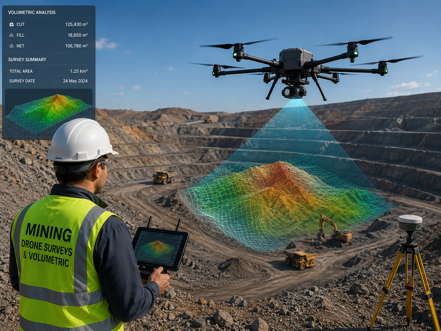
Whether you are managing a limestone quarry, a coal mine, or a metals extraction site, Aerogrid’s drone-based mining survey services give you volumetric data, terrain intelligence, and safety monitoring capabilities that are faster, safer, and more accurate than any ground-based alternative.
Chhattisgarh is one of India’s richest mineral states — home to vast coal, iron ore, bauxite, dolomite, and limestone reserves.
Aerogrid Drone Solutions has developed specific expertise serving the mining sector across this region, delivering LiDAR surveys, photogrammetric stockpile analysis, and mine progression monitoring that integrates with existing mine planning software and reporting systems.
Sending ground surveyors into active mining zones is a safety risk that most operations still accept out of necessity. Drone surveys eliminate that risk entirely.
A pit that would require surveyors to rappel down highwalls or operate near blasting zones can be fully mapped by Aerogrid’s UAVs in a fraction of the time — without putting a single person in danger. For stockpile surveys, our drone-derived volumes replace truck-count estimates that can carry 5–15% error with data accurate to within 2%.
Aerogrid Drone Solutions understands the terrain, regulations, project timelines, and business pressures that define infrastructure development across Chhattisgarh and the Central India.
certified pilots and fully compliant UAV operations.
accurate data validated against ground control points
from flight operations to processed, analysis-ready deliverables.
Rapid mobilization across Chhattisgarh, Madhya Pradesh, Odisha, and Maharashtra
Government-grade projects with strict reporting requirements.
DWG, SHP, LAS, PDF, GeoTIFF, and more