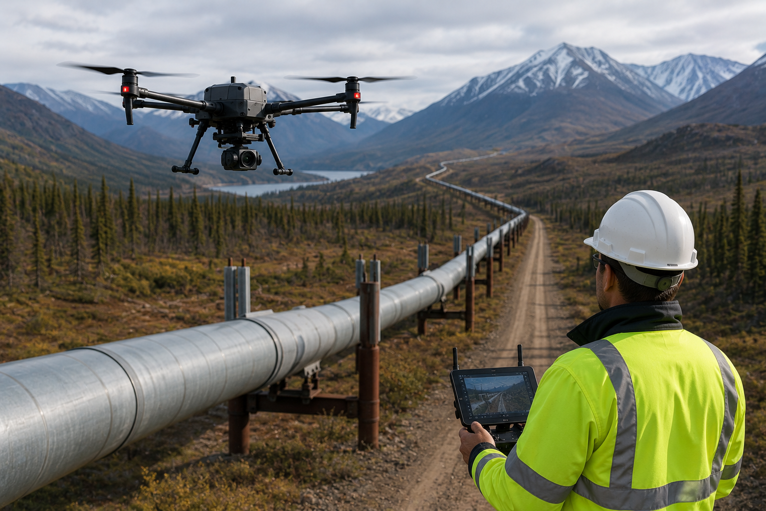
Oil and gas pipelines crossing hundreds of kilometres of varied terrain are among the most challenging infrastructure assets to monitor. Encroachments happen. Soil shifts. Third-party damage occurs. Without regular aerial surveillance, a small issue can become a rupture, a regulatory violation, or a safety incident.
Aerogrid’s drone-based pipeline inspection services give operators the corridor-wide visibility they need to stay ahead of risk — at a cost and speed that ground patrols simply cannot match.
We offer end-to-end aerial inspection services for oil and gas pipelines, including linear corridor mapping, right-of-way surveillance, facility inspection, and thermal anomaly detection.
Our operations are structured to comply with the stringent documentation and reporting requirements of petroleum regulatory authorities.
Many pipeline corridors cross terrain where road-based patrol vehicles cannot effectively operate — forest reserves, ravines, agricultural zones, and floodplains. Aerogrid’s drone operations are not constrained by terrain.
A single day’s operations can cover 80–120 km of corridor, producing geo-tagged inspection data that can be reviewed remotely by engineering teams anywhere.
Aerogrid Drone Solutions understands the terrain, regulations, project timelines, and business pressures that define infrastructure development across Chhattisgarh and the Central India.
certified pilots and fully compliant UAV operations.
accurate data validated against ground control points
from flight operations to processed, analysis-ready deliverables.
Rapid mobilization across Chhattisgarh, Madhya Pradesh, Odisha, and Maharashtra
Government-grade projects with strict reporting requirements.
DWG, SHP, LAS, PDF, GeoTIFF, and more